Showing posts with label map skills. Show all posts

Friday, September 21, 2012

Completed 50 State Project State Strips

My class just finished their state projects, called State Strips. You can find the information on this great research project on two posts I've done, both Teaching the 50 States, and 5th Grade State Research Project: State Strips. You can access the project guidelines for this great research project here (pdf format or docx format). 

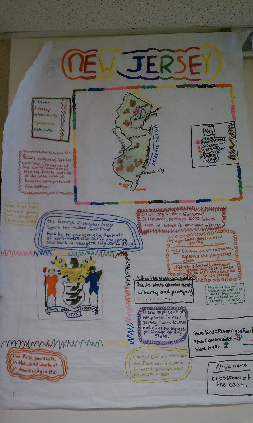
Now that the project is completed, students have also taken the time to present their posters in class. I had students prepare a 1-2 minute long speech in which they taught other students about their state. The exemplary posters were then posted in the hallway. My students love seeing their work in the hallway (and on this blog), so I'm going to show some of the great examples below. Click on any image to see a larger version. 


Monday, September 3, 2012

5th Grade State Research Project: State Strips

Like most teachers, I must adapt from year to year to the needs of my students. Although my 9 week plan for the year in Social Studies states that I like to do a unit on United States Geography (states and capitals) after Unit 5, this year I encountered a group of students who don't have a large background in United States geography (I blame high stakes testing, but alas, I must move on). As it's important information, at least on the surface, to learning United States history, I decided to do this unit now, before getting into United States history. This Unit on Geography focuses heavily on naming and identifying the 50 states, and a basic beginners level understanding of World Geography. By clicking on the links above, you can be taken to various resources that can assist you.

This is how it will look in my classroom:

First off, I will print off a large 3 foot by 3 foot wall map of the United States, have student help cut it out, and post it on a bulletin board in the classroom (get this from MegaMaps). As each student finishes their project, they will go and write the name of their state, and color in their state on the map.

Each student will be provided with a 3 foot by 2 foot strip of butcher paper in which to complete their project on (butcher paper is 3 feet wide, so just measure out 2 foot strips and cut).

Following the PROJECT GUIDELINES (pdf format or docx format), students will have exactly one week to complete their project, which is titled "state strips." The example in the guidelines is just something I drew up, and is nothing fancy. I make it a point to not provide them with anything too specific, because I want to see what they're capable of doing.

Monday, July 30, 2012

Zoom Maps: A Very Simple, Very Effective Tool For Teaching Small to Large Geography or Science Relationships

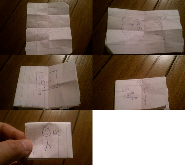
I am currently working on a unit resources page about geography. In 5th grade I teach United States geography, states and capitals, and map skills, but also briefly touch on world geography. I've noticed a disturbing trend over my career. Students in the 5th grade don't often know the difference between countries, states, and continents. They have no concept of distance (they think China is next to Mexico, etc.), and think that major cities are states (countless students have called Los Angeles a state, or California a city, or thought that Los Angeles was California). I like to include this very simple activity I call Zoom Maps. All you need for this activity is a sheet of paper, and something to write with. This is obviously an activity that can be done with much younger students, but I've found success with it in both social studies and science. I do this same foldable to "zoom in" to an atom.

Check out this example I drew up. It's very crude, but it is easy to follow. I hope to upload some student examples once school starts (August 15th here in Las Cruces). CLICK HERE FOR THE PDF DOCUMENT. Enjoy!

Also, here is an animated gif of my very simple and crude example. I made this at Picasion.


picasion.com

Friday, July 20, 2012

Print Huge Wall Sized Maps For Your Classroom

I was doing some browsing earlier, and came across a very simple website with a very awesome idea. At yourchildlearns.com, there is a page called Mega Maps, and let me tell you, these maps can be huge. Any state, country, or continent, from 1 page up to 8 pages by 8 pages (64 total pages),  you can make maps as big as you want. I highly recommend this for your map printing.

Sunday, July 1, 2012

Learning About the Seven Continents Quickly and Easily

Here's a simple post with a simple premise, the seven continents. You'd be surprised how many fifth graders (pretty much most of them) don't know the seven continents, or think that Texas and California are both continents.

I'm going to keep this nice and easy. I don't really have a lot of extra time to teach the continents, but I like for that content to get taught. So, I'll have my students practice by playing the Continent Names game over at PlayKidsGames.com. Next up, I will have them listen to this rap called "The Continents Song." It's a little infectious, easy to pick up, and within a week, the kids know the names of the seven continents. That was easy!


Saturday, June 30, 2012

All About Our City: Las Cruces

With this post, I think I pretty much let the cat out of the bag on the fact that I live in Las Cruces, New Mexico. I've lived here since 2000, and love this great little city in southern New Mexico. So for my students, this means that you'll spend some time during the school year learning about Las Cruces and the Mesilla Valley. We will study Las Cruces and the Mesilla Valley as it is now, and the history of the area.

When studying Las Cruces and the area, you'll need to first focus on some facts. Let's start with demographic information. What I mean by demographic information is data about certain portions of the population. In kid words, I mean that we need to find facts about people living in Las Cruces (like how much money they make on average, or what percentage finished college, etc.). Use the following websites to find some good demographic data about Las Cruces:

Sites with demographic facts about Las Cruces:
Hopefully you notice right from the start that the data you find one each of these sites isn't the same. Why might this be? It's because some of the data is older, and some of it is just estimations while others are based on certain studies. Look for the numbers to be close to know that they're correct.

Next up, let's learn about the history of the Mesilla Valley. Use the following websites to find some good historical facts about the area:

Sites with historical information about Las Cruces and the Mesilla Valley:
Finally, we're going to use this information to create a profile of the area. I made a video about eight years ago that showed historical photos of the area alongside newer photos of the area. Using the Rio Grande Historical Collections, we are going to find photos that we can match to their current locations. I will make a trip to take photos of what these areas look like now, and we will make an updated version of this video, which I will then post to this blog (how fun!). 

Using your information, as well as some photos from the collections linked to above, you have a few options:

1. Head over to Prezi, and create a 15+ slide presentation about the area. 
2. Create a 15+ slide Animoto about the area.
3. Print the information, and make a poster board with at least 10 facts and 5 photos.
4. Write an 8+ paragraph research paper synthesizing your findings. 

Finally, we are going to create a large reproduction of a map of Las Cruces and Mesilla, and place some major landmarks on it. These landmarks include: our school, city hall, NMSU, the district, magistrate, and county court houses, Mesilla Plaza (and in Mesilla Plaza, La Posta, Fountain Theater, abnd San Albino Basilica), downtown, five restaurants, five favorite places of entertainment, and ten major roads).

We are going to use Google Maps, and will project this map of Las Cruces on the board for everyone to see.