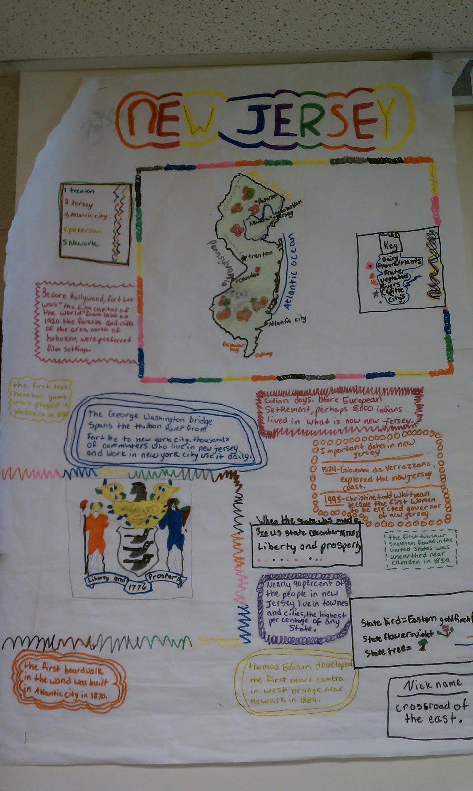
My class just finished their state projects, called State Strips. You can find the information on this great research project on two posts I've done, both Teaching the 50 States, and 5th Grade State Research Project: State Strips. You can access the project guidelines for this great research project here (pdf format or docx format). Now that the project is completed, students have also taken the time to present their posters in class. I had students prepare a 1-2 minute long speech in which they taught other students about their state. The exemplary posters were then posted in the hallway. My students love seeing their work in the hallway (and on this blog), so I'm going to show some of the great examples below. Click on any image to see a larger version.
I recently posted about our current project in social studies (as of September 10th) in a post titled 5th Grade State Research Project: State Strips. Our state strips are off and running. The due date for them in next Wednesday, which means students will have had 10 in class days to finish these projects. We're still fairly early on, but I'm seeing some great progress. Here are some photos of this great project based learning project in action:
Hard at work on Rhode Island. You can see that this student has gotten the title, and is working on facts using one of the classroom atlas books.
This picture shows how we really have to spread out to accommodate for 24 students making posters. We're using every inch of desk and floor space during social studies time, and the kids love it!
Hard at work on Texas. Notice the detail, I'm having students trace their states off of the projector.
More students hard at work with the big map in the background to reinforce the idea of where these states are located.
A great free hand drawing of Colorado's state flag.
Like most teachers, I must adapt from year to year to the needs of my students. Although my 9 week plan for the year in Social Studies states that I like to do a unit on United States Geography (states and capitals) after Unit 5, this year I encountered a group of students who don't have a large background in United States geography (I blame high stakes testing, but alas, I must move on). As it's important information, at least on the surface, to learning United States history, I decided to do this unit now, before getting into United States history. This Unit on Geography focuses heavily on naming and identifying the 50 states, and a basic beginners level understanding of World Geography. By clicking on the links above, you can be taken to various resources that can assist you.
This is how it will look in my classroom:
First off, I will print off a large 3 foot by 3 foot wall map of the United States, have student help cut it out, and post it on a bulletin board in the classroom (get this from MegaMaps). As each student finishes their project, they will go and write the name of their state, and color in their state on the map.
Each student will be provided with a 3 foot by 2 foot strip of butcher paper in which to complete their project on (butcher paper is 3 feet wide, so just measure out 2 foot strips and cut).
Following the PROJECT GUIDELINES (pdf format or docx format), students will have exactly one week to complete their project, which is titled "state strips." The example in the guidelines is just something I drew up, and is nothing fancy. I make it a point to not provide them with anything too specific, because I want to see what they're capable of doing.
I was doing some browsing earlier, and came across a very simple website with a very awesome idea. At yourchildlearns.com, there is a page called Mega Maps, and let me tell you, these maps can be huge. Any state, country, or continent, from 1 page up to 8 pages by 8 pages (64 total pages), you can make maps as big as you want. I highly recommend this for your map printing.
It's shocking how little kids these days know about geography. From hearing a 5th grader say that China is a state, to having another student believe that New Mexico and Mexico are the same thing, it's enough to make you want to do something about it. Well, even though it's a stretch to fit state standards (or common core, depending on where you are), it needs to be taught. I've found a few resources to teach the 50 states that don't seriously impede on class time, and are engaging for students.
Right from the start of the school year, I play this little video each and every day before students head out the door to lunch (or recess, whatever suits your fancy).
The video is set to the lyrics, but if you'd like to have a copy to give to your students, go ahead and download the document HERE.
This song does a great job of teaching students the names of the 50 states, but it doesn't teach them shapes unless you actually show them the video each time (I just download the music to an mp3 file and play it that way), locations, or capitals. There are simple and effective ways to match states with their shapes, including these great Flash Cards (the site is already set up for printing).
If you have time, you might want to assign a research project to your students. I have done this both as a research paper and a poster. I prefer doing a poster, where each student gets a 2' x 2' cut of colored butcher paper (I'm assuming that most schools have rolls upon rolls of colored butcher paper), and must research something similar to the following information:
— State motto — State flower — State tree — Date of Statehood — Nickname — State flag — State bird — current events — current events — Drawing of the state — Drawing of the state within the United States
If your students have atlas' with information about each state, or a set of encyclopedias, then these are great resources to use. If you don't, consider Enchanted Learning, they have great information on each state.
Finally, your students are ready to challenge themselves with an activity that I'd be willing to bet a number of teachers and a majority of American adults couldn't do. Blindly placing each state on the map of the United States. The game is called Place the States, and is provided by Sheppard Software.